Robert Cheek's Route
from Virginia to North Carolina
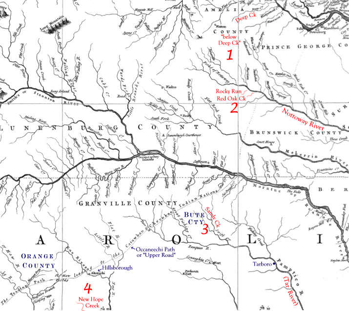
The following map shows Robert Cheek's route from Amelia County, Virginia, to Orange County, North Carolina. The Occaneechi Path or "Upper Road" was a major route for settlers and traders traveling to the frontiers of North and South Carolina.
- Early 1750's, Raleigh Parish, Amelia Co., VA, "below Deep Creek."
- Mid-1750's to 1762, Brunswick Co., VA, south side of Nottoway River at Rocky Run & Red Oak Creek.
- 1762 to mid-1770's, Bute Co., NC, south side of Sandy Creek.
- By 1778, Orange Co., NC, New Hope
Creek.